The sun was shining on a mild Sunday afternoon, so I decided to go poke around in Yocom Park. I'm wondering how many have done that lately.
 |
| The most frequently used features of the park --- playground, shelter and restrooms are located on higher ground in the northeast corner of the park. |
It's been obvious from comments on Facebook and elsewhere regarding yesterday's "Lake Como to Yocom Park" post, that many who grew up in Chariton have pleasant memories of it. I especially liked the stories of children from the various elementary schools walking to the park as the academic year wound down for a joint "play day," carrying sack lunches. And of tennis on the courts in the park's southeast corner. Since I grew up near Russell, my most vivid memories involve 4th of July fireworks.
 |
Familiar landmarks at the intersection of North 7th and Roland, now the park's principal entrance, include the Community of Christ church, built during 1917 ...
|
Keep in mind there's nothing critically wrong with the park, other than the deteriorated tennis court area. It just looks as if it could use a little love --- and more use. So go take a walk around its terraces one of these days and admire the big sycamores.
 |
| A sturdy (and attractive) metal fence prevents kiddos from inadvertently ending up on Highway 14 (North 7th Street) while using the playground. |
All of the terraces, connected by shallow concrete stairs, remain in place --- it's interesting to walk the terraces to see how they work together. Occasional handprints remain to remind passers by that kids were present at the creation here.
The ball field nestles up against the north and northeasterly terraces, shaded by large sycamores planted when the park was developed.
Parking is a challenge at Yocom Park. It's forbidden along Highway 14, the west boundary; and the alley along the south boundary is neither wide nor in especially good repair. Roland Avenue, bordering the park to the north, offers paking on one side. North 6th Street is wider, but access down this stairway would challenge some, then it's a long march to the amenities at the park's northeast corner.
It is, however, possible to get the best idea of the park's size from this vantage point at the foot of the east stairs.
If you follow the most southerly terrace due west, you're walking toward what once was the main entrance to the park --- The two blocks of Braden Avenue that begin at the northeast corner of the square and end with a "T" at Highway 14/North 7th Street. Since Highway 14 is busy and there are no crosswalks here, few utilize this route into the park now.
Turn north toward the shelter and playground and the terracing becomes evident again. This area appears overgrown --- and it is, with forsythia and lilac bushes that were part of the original planting scheme but haven't been pruned in many years.
The most expensive issues in the park probably involve the tennis courts in the far southeast corner.
Currently, the entrance is via this intimidating set of stairs down from street level.
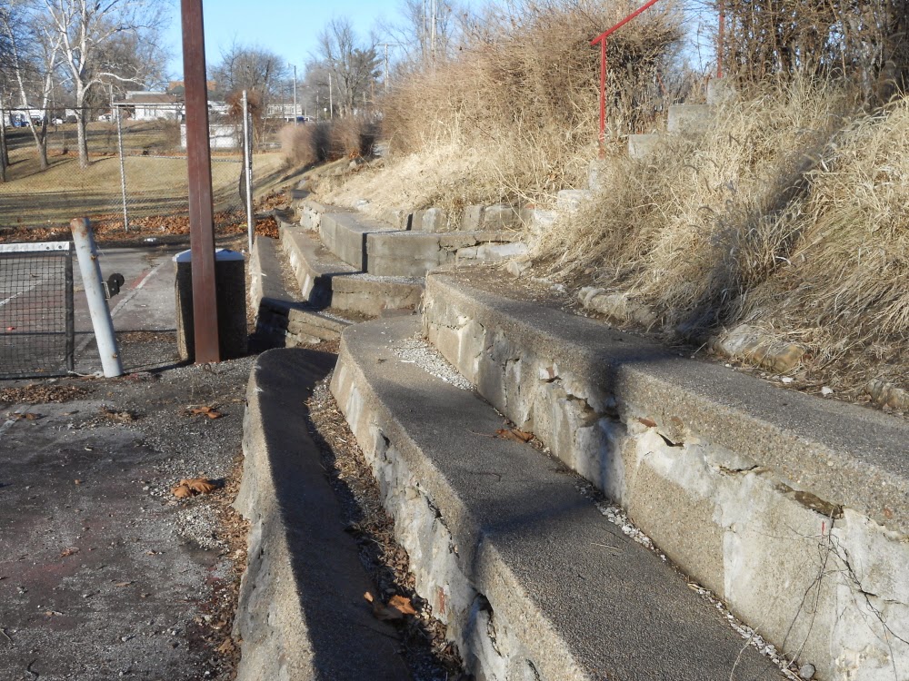
Stonework bleachers along the east edge of the court are deteriorating.
And the court itself just doesn't look inviting when there are newer and better maintained courts elsewhere in town. I kind of doubt that the lights are connected either, although I didn't pick up the wire connected to a pole along the alley laying on the court to make sure it was dead.


1 comment:
Fourth of July fireworks, the playground, picnics, softball games...remember all of those. But my fave memory is sledding in the winter. We lived at the east end of Roland, so it was a quick walk down the hill on 6th to the ball field and Sledding Heaven!
Post a Comment