

As it happened, I was in Vietnam when newly confined waters of the Chariton River rose to flood its ancient valley and had returned to graduate school in Iowa City by the time President Nixon dedicated Rathbun Dam on July 31, 1971.
So I remember the old landscape as it was and still have mixed feelings about what was lost --- including some good neighbors --- even though the vast lake is beautiful, especially in autumn, and I like to go there.

I was home on leave (or perhaps it was earlier and I was just home from college), when my parents and I drove down the valley for the last time, crossing the Chariton River at Milledgeville --- traces of the old town still were there --- then twisted northeasterly up a hill to the small cemetery above --- all that remains now.

And I hadn't really planned to visit Milledgeville on Friday, but there's a sense of urgency now that fall colors are reaching their peak and I wanted to see how the autumn leaves looked against a background of water.
So after finishing an errand in Corydon, I took the long way home --- via Promise City, Confidence, Milledgeville and Russell.
To find Milledgeville, it helps to know where to turn left once you've crossed the bridge that spans the upper end of the lake north of Brushy Church and Cemetery. Driving up from the south, the first road leads down to the lakeshore past a Mormon Trail marker overlooking drowned Milledgeville; the second is the driveway to a small store and cluster of related buildings; and the third --- at the top of the hill --- is the stub of the road that once led to Milledgeville but now dead-ends at the cemetery.
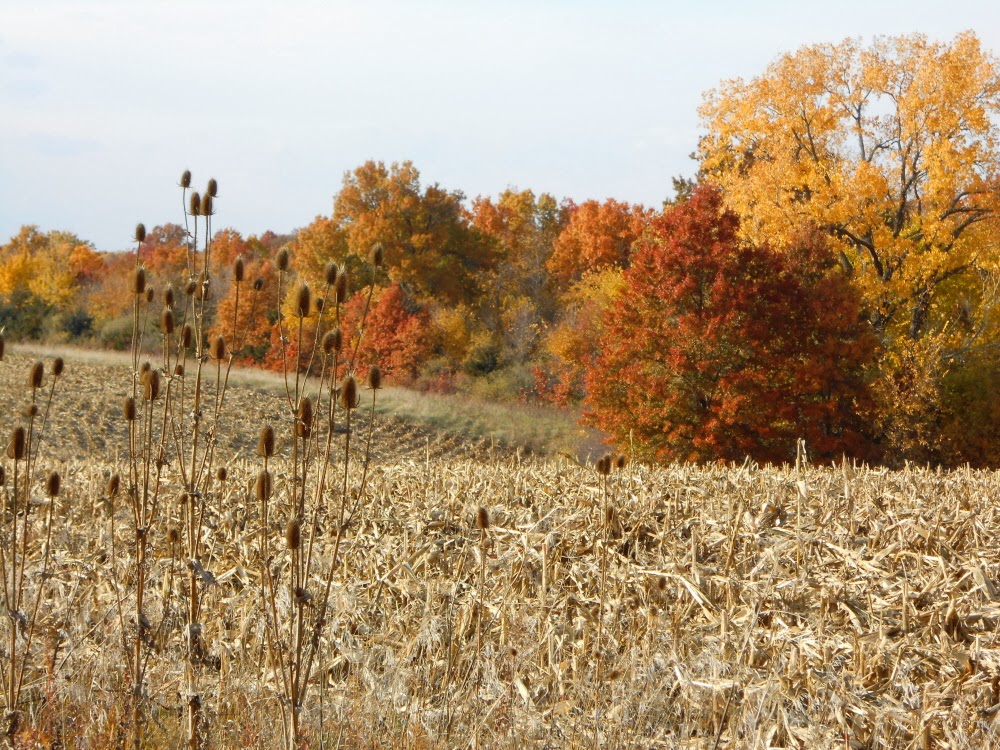
There's a newly harvested field to the north before timber closes in and the clutter of post-lake construction here and there to the south.

The sun was darting in and out among clouds as I drove up to the gates, altering the nature of the light from one minute to the next.
The cemetery is small, a finger of cleared land pointing west down the spine of the hill, edged by Corps of Engineers chain-link fence. The cemetery ends just before the land drops away to the lake and its waters are visible now in the distance as leaves fall.

Once upon a time, the road turned right just south of the cemetery, then turned again and angled steeply down to old Milledgeville, on the Chariton's north bank. You can see the location here in an 1875 map from the the Andreas Atlas.

The late Bill Heusinkveld in his masterful "Towns of Appanoose County Past and Present," published in 2003, tells us that "the village of Milledgeville was platted in 1857 by William Chadwick, Justice of the Peace" and that when the dam was completed a few buildings remained. "A few foundations can sometimes be seen at the edge of the lake at low water levels," he wrote.
"Before the pioneers arrived," Heusinkveld continues, "this was an area of Indian activity. There were 21 prehistoric earthen mounds in the vicinity, now under 4 feet of water. At that location, the river had a limestone rocky bottom and there was a rocky ripple on the far side. The Indians once had a fish trap somewhat above the ripple. This was an ideal location for the gristmill to be built on the river edge, leading to the name of the village."
In other words, Mill-edge-ville.
Milledgeville has considerable significance, too, in the history of the Mormon Trail through southern Iowa. The initial route, used by Brigham Young and others in flight from Nauvoo west during the spring of 1846, swung far to the south in Appanoose County, then angled up across Wayne to Garden Grove, now in Decatur County.
That route was abandoned almost immediately, however, and from the summer of 1846 into 1849, the Saints used a northerly route, angling northwest just beyond Iconium (a mile or so northeast of Milledgeville) to follow the broad ridge dividing the Missouri and Mississippi River drainages through what became Lucas County to Chariton, then angling southwest from Chariton Point to Smyrna in Clarke County.
In 1849, however, an easy Chariton River crossing was developed at the Milledgeville site and from that time forward, a majority of the Mormon pioneers crossed here, then headed west across Wayne County on a more direct route to Garden Grove.
Milledgeville "was founded by Harrison Anderson on Dec. 2, 1857," according to Heusinkveld. "It consisted of about a dozen houses, a store, a large hotel, a saloon and a gristmill. There was a post office from 1854 to 1903. The hotel and mill were owned by William Peppers, Elyfhus and Martha Chadwick ran the general store. They had ten children, one named Emilia. Emilia, as a little girl, always laid flowers on the grave of a Mormon baby who had perished on the Mormon trek westward. The grave probably was the first grave in the Milledgeville Cemetery."

Heusinkveld tells us, too, that the village church was constructed on the hilltop just east of the cemetery, but that it did not last far into the 20th century.
"Everything left was abandoned at the time the Rathbun Dam was completed," Heusinkveld writes.
I thought about driving on from Milledgeville to Honey Creek State Park, or perhaps Evans Cemetery, which I've been planning to revisit for a year or two, but it was getting late and so I retraced the route through Confidence and headed home.
Maybe I'll head back down that way another day, before the colors fade.

2 comments:
Frank, Thanks for the history and the pictures are just gorgeous. Glad you decided to make the trip.
Frank - I'd (and others)
would be interested in where your love of local history came from. I lived in Chariton from 1927 t0 1949 and you find interesting place I have never even heard of. Thanks so much for your talent and time. Makes me love my heritage more and more.
Post a Comment