

I entertained myself before Friday's homecoming parade by trying to match early post card views of the north and east sides of Chariton's square. The sun was in the right place to do this and the crowd made the operation livelier than it would have been, say, on a Sunday afternoon.
This is the north side, using postcard views collected by the late Gary Tharp, now in the collection of the Lucas County Historical Society. Although Gary spent much of his adult life in the East, then in California, he remained intensely interested in Lucas County history and I wish various computer crashes along the way hadn't wiped out my correspondence with him.
The view at the top here, looking from west to east, probably dates from not long after 1900 (I figured this all out one time, but can't find those notes). By that time, fires had wiped out all of the buildings.in the west half of the block other than the "Mallory Brick," the two-story building adjoining the alley where U.S. Bank now is located. Although whoever hand-colored the image used to produce this card made all the bricks a uniform red, bricks used in the newer buildings here actually are in various shades of brown popular at the turn of the 20th century. Notably missing is the Charitone Hotel, which now anchors the northeast corner of the square.

By the time the second photo was taken during the 1920s, Mallory Brick had been replaced with a building that matches its neighbor to the west and the Charitone also had been built. Below is the same view, taken Friday. The most notable changes are the post and shingle arcade that now obscures street-level facades and second-floor windows of the Smyth Building that have been blinded.

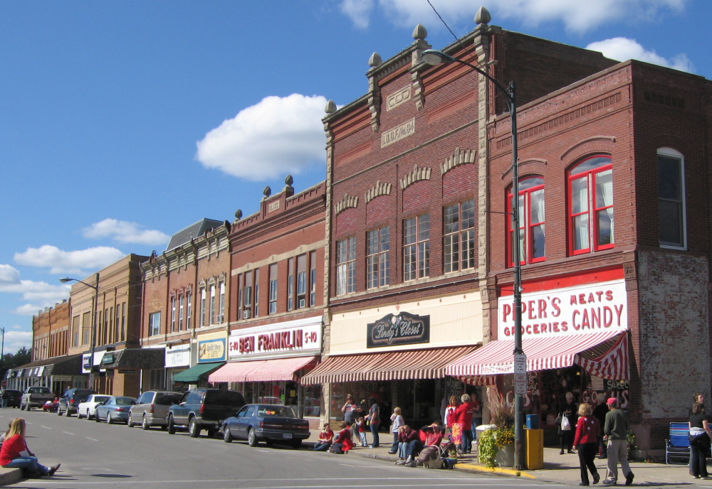
All of the buildings in the east half of the north side are older and more uniform in color --- the three-front Brown Block just east of the alley, the double-front Blake Building, the double-front I.O.O.F. Building and the Piper's Building, which because of its size when compared to the I.O.O.F. Building manages to look a little like a child holding hands with a parent.

Here's the same view taken during the 1950s. Note in both that the three-story Union Block (or First National Bank building) anchors the northwest corner of the square. Its destruction in order to clear the way for the squat blond strip-mallish bank building now there probably was the biggest non-disaster loss suffered to date by the squarescape.

And here's roughtly the same view on Friday. Although the buildings are easily recognizable and not substantially altered, the only veteran business remaining is Piper's.
There will be more of this sort of thing here as the days pass because I'm starting a new blog, "Chariton's Square Deal." And yes, I know, the previous new blog, "Mallory's Castle," hasn't been progressing with lightning speed. But I'm going to do it anyway. Square Deal isn't presentable yet, but when it is I'll link it out of the sidebar.
No comments:
Post a Comment